 |
||||||||||||||||||||||||||||||||||||||||||||
|
National Park and Surrounding Areas |
||||||||||||||||||||||||||||||||||||||||||||
|
|
||||||||||||||||||||||||||||||||||||||||||||
|
|
||||||||||||||||||||||||||||||||||||||||||||
 |
||||||||||||||||||||||||||||||||||||||||||||
|
Summit elevation: 14,255 feet Trailhead elevation: 9,400 feet Net elevation gain: 4,855 feet Longs Peak Trailhead Rocky Mountain National Park |
||||||||||||||||||||||||||||||||||||||||||||
|
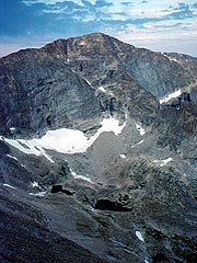
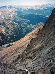
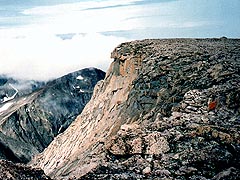
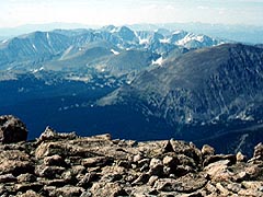
Longs Peak is often considered the classic Rocky Mountain National Park experience. The popular Keyhole Route is only open in late summer months to day hikers wanting to reach the top of the Estes Park area's only "fourteener" summit. |
||||||||||||||||||||||||||||||||||||||||||||
 |
||||||||||||||||||||||||||||||||||||||||||||
|
|
||||||||||||||||||||||||||||||||||||||||||||
|
|
||||||||||||||||||||||||||||||||||||||||||||
|
Junction of Chasm Lake and Longs Peak Trails (3.5 miles one-way from trailhead) Granite Pass, North Longs Peak Trail junction (4.2 miles one-way from trailhead) Boulder Field (5.7 miles one-way from trailhead) - end of maintained trail The Keyhole (6.2 miles one-way from trailhead) - not accessible by maintained trail |
||||||||||||||||||||||||||||||||||||||||||||
|
Chasm Lake (4.2 miles one-way from trailhead) - via the Chasm Lake Trail Mount Lady Washington (4.5 miles one-way from trailhead) - via Longs Peak Trail to an unmaintained route Storm Peak (6.3 miles one-way from trailhead) - via Longs Peak Trail to an unmaintained route |
||||||||||||||||||||||||||||||||||||||||||||
|
Goblin's Forest (1.2 miles one-way from trailhead) - 6 individual sites Battle Mountain (2.8 miles one-way from trailhead) - 1 group site Boulderfield (6.0 miles one-way from trailhead) - 9 individual sites |
||||||||||||||||||||||||||||||||||||||||||||
|
|
||||||||||||||||||||||||||||||||||||||||||||
|
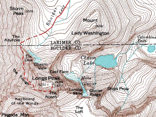
Meeker Park. Longs Peak Road provides access to the trailhead from Colorado Highway 7. Turn west on to Longs Peak Road from Highway 7 at a junction approximately 9 miles south of Estes Park, or 2 miles north of Meeker Park. Look for a left (south) turn to the trailhead parking area, about 1 mile from Highway 7, where Longs Peak Road continues straight (west) to the Longs Peak Campground. Before planning this hike, verify with the Park Service that the Keyhole Route is open to non-technical hikers. There is normally a window from mid-July through September when ice and snow melt out in the Trough and the trail is designated as non-technical. Beyond the Boulder Field, 5.7 miles from the trailhead, the visible trail disappears. For the last 1.8 miles to the summit, hikers must follow route markers in some areas, but the route is generally easy to follow. Note that the route passes along several exposed sections beyond the Keyhole, and several parts of this final ascent are quite steep. Due to the threat of daytime thunderstorms and lightning, it is advisable to start the day hike to Longs Peak summit well before sunrise. |
||||||||||||||||||||||||||||||||||||||||||||
|
|
||||||||||||||||||||||||||||||||||||||||||||
|
|
||||||||||||||||||||||||||||||||||||||||||||
 |
 |
|||||||||||||||||||||||||||||||||||||||||||
|
|
|
|||||||||||||||||||||||||||||||||||||||||||
 |
 |
|||||||||||||||||||||||||||||||||||||||||||
|
|
|
|||||||||||||||||||||||||||||||||||||||||||
|
|
||||||||||||||||||||||||||||||||||||||||||||
|
|
||||||||||||||||||||||||||||||||||||||||||||
 |
||||||||||||||||||||||||||||||||||||||||||||
|
|
||||||||||||||||||||||||||||||||||||||||||||
 |
||||||||||||||||||||||||||||||||||||||||||||
 |
||||||||||||||||||||||||||||||||||||||||||||
 |
||||||||||||||||||||||||||||||||||||||||||||
|
|
||||||||||||||||||||||||||||||||||||||||||||
|
|
||||||||||||||||||||||||||||||||||||||||||||
|
|
||||||||||||||||||||||||||||||||||||||||||||
|
Topographic map is property of and copyrighted by Maps a la carte, Inc., and is used on this site with permission. |
||||||||||||||||||||||||||||||||||||||||||||