 |
||||||||||||||||||||||||||||||||||||||||||
|
National Park and Surrounding Areas |
||||||||||||||||||||||||||||||||||||||||||
|
|
||||||||||||||||||||||||||||||||||||||||||
|
|
||||||||||||||||||||||||||||||||||||||||||
 |
||||||||||||||||||||||||||||||||||||||||||
|
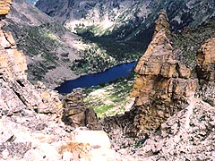
leads past Long Lake and Lake Isabelle before climbly a steep grade above timberline. The pass is on the Continental Divide between Pawnee Peak and Shoshoni Peak. The trail is an excellent way to see the grand scenery of the Indian Peak Wilderness. |
Summit elevation: 12,541 feet Trailhead elevation: 10,480 feet Net elevation gain: 2,061 feet Long Lake Trailhead Indian Peaks Wilderness |
|||||||||||||||||||||||||||||||||||||||||
 |
||||||||||||||||||||||||||||||||||||||||||
|
|
||||||||||||||||||||||||||||||||||||||||||
|
|
||||||||||||||||||||||||||||||||||||||||||
|
Long Lake (0.3 miles one-way from trailhead) Junction of Jean Lunnings and Pawnee Pass Trails (at Long Lake) Lake Isabelle (2.0 miles one-way from trailhead) Junction of Isabelle Glacier and Pawnee Pass Trails (at Lake Isabelle) |
||||||||||||||||||||||||||||||||||||||||||
|
Pawnee Peak (4.5 miles one-way from trailhead) - via unmaintained route beyond Pawnee Pass |
||||||||||||||||||||||||||||||||||||||||||
|
The Indian Peaks Wilderness does not have designated campsites in the same way as Rocky Mountain National Park. Camping information in the Mount Audubon area is available by calling 303-541-2500. |
||||||||||||||||||||||||||||||||||||||||||
|
|
||||||||||||||||||||||||||||||||||||||||||
|
To reach to trailhead parking area, drive on Colorado Highway 72 to the vicinity of the town of Ward. Just north of Ward on Highway 72, there is a large sign marking a road leading west to Brainard Lake. Follow Brainard Lake Road for about 6 miles to Brainard Lake. The Long Lake Trailhead parking area is accessed from a left-hand turn just past the lake. Brainard Lake Road remains closed at about the halfway point between Highway 72 and Brainard Lake until after most of the spring snowfall has melted, which is in late June or early July in most years. There is an entrance fee collected for driving into the Brainard Lake area. From the Long Lake Trailhead, hike west past Long Lake to Lake Isabelle. At Lake Isabelle, there is a trail junction with the trails to Isabelle Glacier and Pawnee Pass. The trail to Pawnee Pass leads uphill to the right at this junction. The trail leads up steep slopes above timberline, leading to the pass on the Continental Divide. |
||||||||||||||||||||||||||||||||||||||||||
|
|
||||||||||||||||||||||||||||||||||||||||||
|
|
||||||||||||||||||||||||||||||||||||||||||
 |
 |
|||||||||||||||||||||||||||||||||||||||||
|
|
|
|||||||||||||||||||||||||||||||||||||||||
|
|
||||||||||||||||||||||||||||||||||||||||||
|
|
||||||||||||||||||||||||||||||||||||||||||
 |
||||||||||||||||||||||||||||||||||||||||||
|
|
||||||||||||||||||||||||||||||||||||||||||
 |
||||||||||||||||||||||||||||||||||||||||||
 |
||||||||||||||||||||||||||||||||||||||||||
 |
||||||||||||||||||||||||||||||||||||||||||
|
|
||||||||||||||||||||||||||||||||||||||||||
|
|
||||||||||||||||||||||||||||||||||||||||||
|
|
||||||||||||||||||||||||||||||||||||||||||
|
Topographic map is property of and copyrighted by Maps a la carte, Inc., and is used on this site with permission. |
||||||||||||||||||||||||||||||||||||||||||